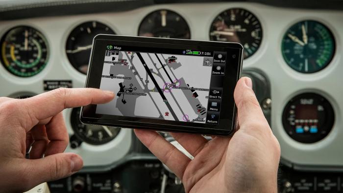
Garmin (Booth 1822) is unveiling its new aera 660 handheld aviation GPS optimized for the helicopter market. The $849 aera 660 features a five-inch capacitive touchscreen, interactive maps, built-in GPS/Glonass receiver, Connext wireless capabilities, WireAware wire-strike avoidance database and additional database options and built-in Wi-Fi database updating capabilities, including daily U.S. fuel prices. Bluetooth supports the display of ADS-B in traffic and weather from a variety of sources including the GDL 39/GDL 39 3D, Flight Stream and the GTX 345 ADS-B transponder.
Garmin said the aera 660 is designed to withstand harsh environments and meets stringent temperature tests and helicopter vibration standards. A mini-USB connector, micro SD card slot and removable battery accompany a dedicated power button along the bezel of the aera 660. The unit will run up to four hours on a single charge, although longer times are possible. The device can be updated when connected to Wi-Fi without the need to connect to a computer. Pairing the area with the GTX 345, Flight Stream or the GDL 39 3D displays backup attitude information. Without an attitude source, the aera 660 displays GPS-derived airspeed, altitude and vertical speed, alongside flight plan information on a dedicated 3D Vision page. The 3D Vision page optionally displays primary flight instruments as gauges or tapes. The 660 supports connectivity with Garmin’s Virb XE action camera, so pilots can control recording and take photos via the aera 660’s display.
When paired with the GTX 345, Flight Stream or the GDL 39/GDL 39 3D, ADS-B in traffic and weather is wirelessly transferred and displayed on the aera. ADS-B traffic information may be viewed on the moving-map page and dedicated traffic pages, which also leverage Gamin’s TargetTrend relative-motion technology to help pilots visualize closure rate of nearby traffic targets, and TerminalTraffic, which detects and displays other aircraft or ground vehicles on runways and taxiways broadcasting ADS-B position information. Subscription-free flight information service broadcast (FIS-B) weather can be overlaid on the map page and displayed on dedicated weather pages. The aera 660 also animates Nexrad radar imagery.
The aera 660 may be qualified for use as either a Class I or Class II electronic flight bag. Geo-referenced IFR en route, VFR sectional charts and Garmin FliteCharts terminal procedures are pre-loaded. Garmin ChartView allows display of Jeppesen charts with an optional subscription. Garmin SafeTaxi airport diagrams aid in situational awareness by identifying runways, taxiways, FBOs and airport buildings. Fuel price data is accessible on the map or within the airport directory database.
Several features will be of particular interest to helicopter operators, including the WireAware and City Navigator functions. WireAware overlays power line locations and relative altitude information on the moving map. Altitude display is offered in both msl and agl. The standard obstacle database contains hazardous obstacle transmission (HOT) lines including those that span rivers, canyons, valleys or those in the vicinity or airports. Obstacle databases and power line/hot line coverage are available for the U.S. and portions of Canada and Mexico.
Dual serial ports on the aera 660 enable connectivity with other hardware such as Garmin navigators. The aera 660 can receive flightplan data entered into the navigator by connecting it via an optional bare wires kit. When paired with a navcom, frequencies and identifiers also can be transferred from the aera to the corresponding navcom.
Additionally, the expanded Garmin navigation database now incorporates the option to load and activate instrument approach procedures from the final approach fix to the runway with the option to activate vectors-to-final, making it easier to monitor the position of the aircraft relative to the approach. New Garmin navigation databases start at $29.95 for a single update and bundles are available starting at $149.95 annually.